
BID EVERY LOT
BEFORE THE FIRST SNOW.
Measure parking lots from satellite imagery without walking them. Trace the lot and get its acres. Draw curbs, drive lanes and sidewalks by hand and get their length or area.
Your first project is free, with full totals and the PDF report.
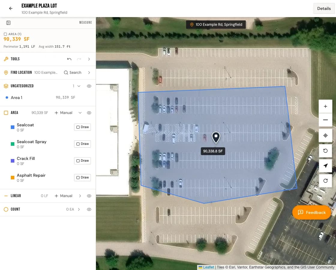
THE WHOLE SITE, ONE MAP
Lot area in acres
Trace the lot on the satellite map. ProPaving totals each area in square feet, square yards and acres. Cut out islands and buildings so they come off the total.
Drive lanes
Draw a drive lane as its own area to get its square feet, or as a line to get its length in feet.
Sidewalks
Draw walks as areas or lines. Put them in your own category so they total apart from the lot.
Curbs
Trace curbs with the line tool and get linear feet for each run.
FROM ADDRESS TO REPORT
- 1
Find the property
Search the address and the satellite map opens on the lot.
- 2
Trace what you clear
Draw the lot, then the drive lanes, walks and curbs by hand.
- 3
Send the report
Export a PDF with the map, the project total in square feet, square yards and acres, and the square feet of each area.
$49 per seat per month. Your first project is free.